research
Environmental AI & Sustainable Systems
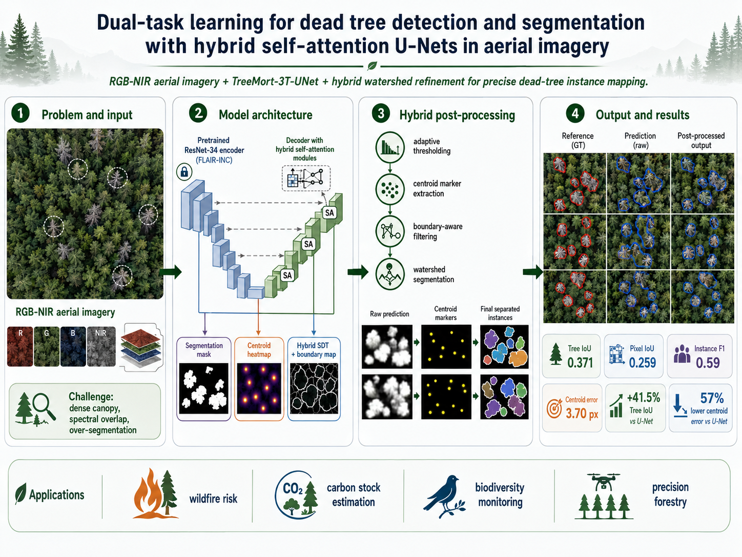
Dead-tree detection and segmentation
Dual-task learning for detecting and segmenting dead trees in aerial imagery with hybrid self-attention U-Nets.
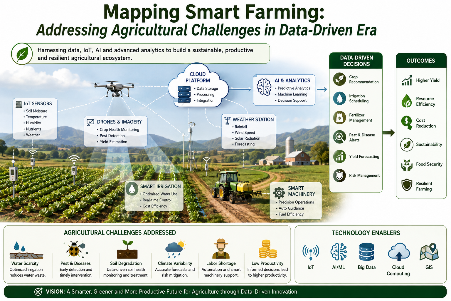
Mapping smart farming systems
A review of data-driven smart farming architectures and the agricultural challenges they address across sensing, connectivity, and decision support.
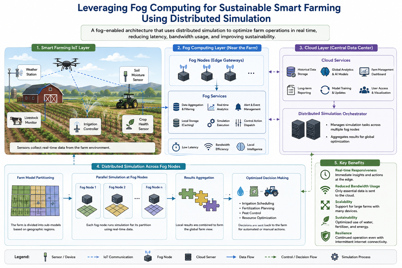
Fog computing for sustainable smart farming
Distributed simulation methods for smart farming that combine IoT connectivity, fog computing, and end-to-end data transmission models.
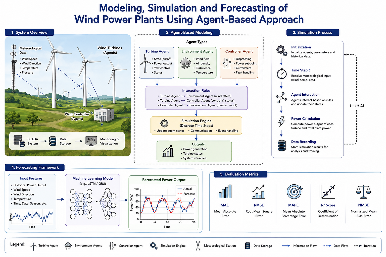
Wind power plant modelling and forecasting
Agent-based modelling, simulation, and forecasting workflows for wind power plants and renewable-energy planning.
HPC, GPU & Computational Vision
Hmsc-HPC GPU acceleration
GPU porting and optimization for joint species distribution modelling, enabling faster ecological modelling workflows on modern accelerators.
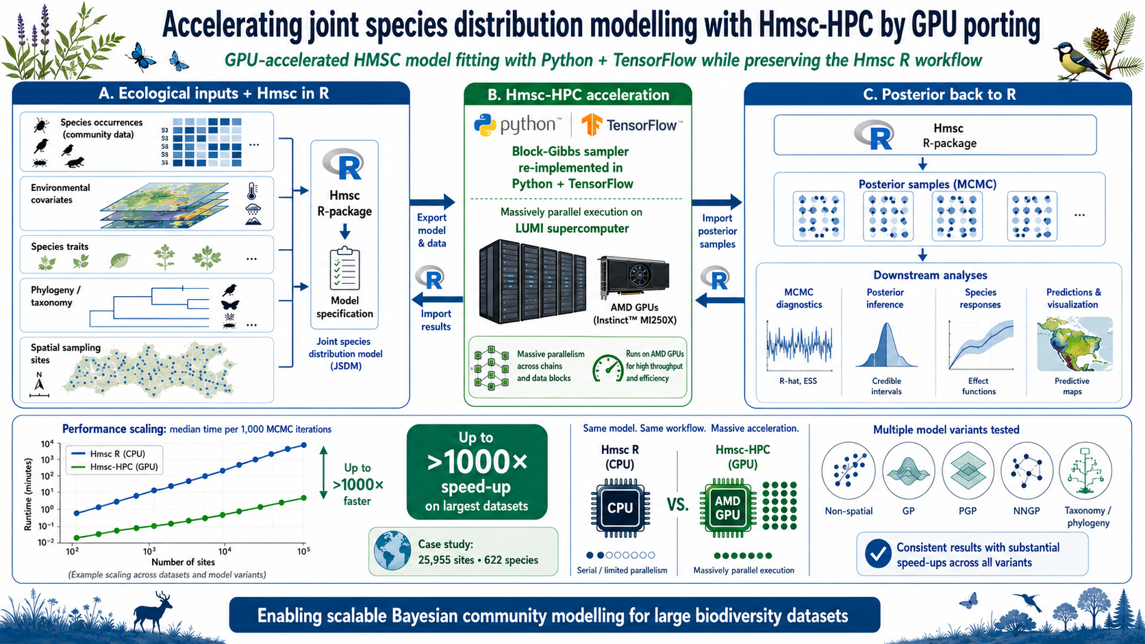
GPU motion estimation for visual saliency
GPU implementation of motion estimation components for real-time visual saliency computation.
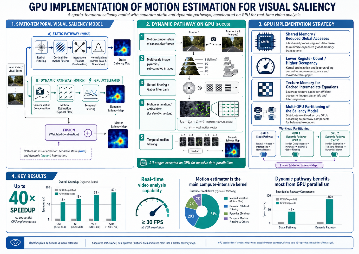
Parallel spatiotemporal visual saliency
Parallel implementation of spatiotemporal visual saliency models for computationally intensive video analysis.
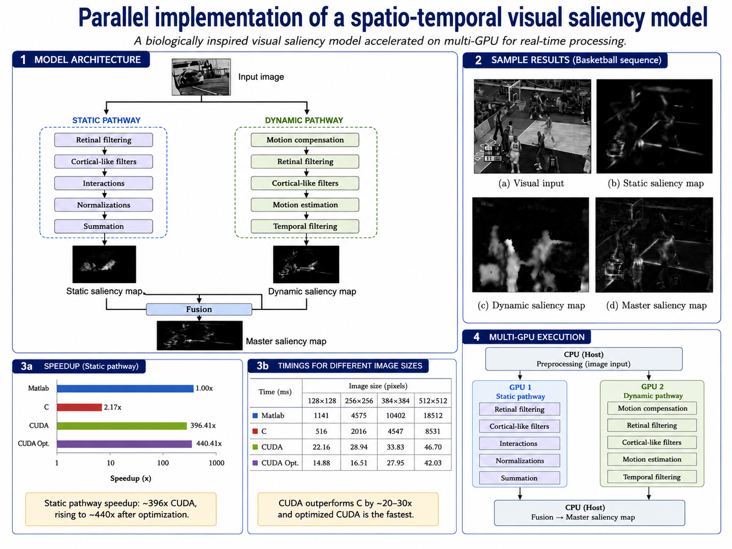
GPU-accelerated neural data processing
GPU acceleration for multivariate empirical mode decomposition at massive neural-data scale.
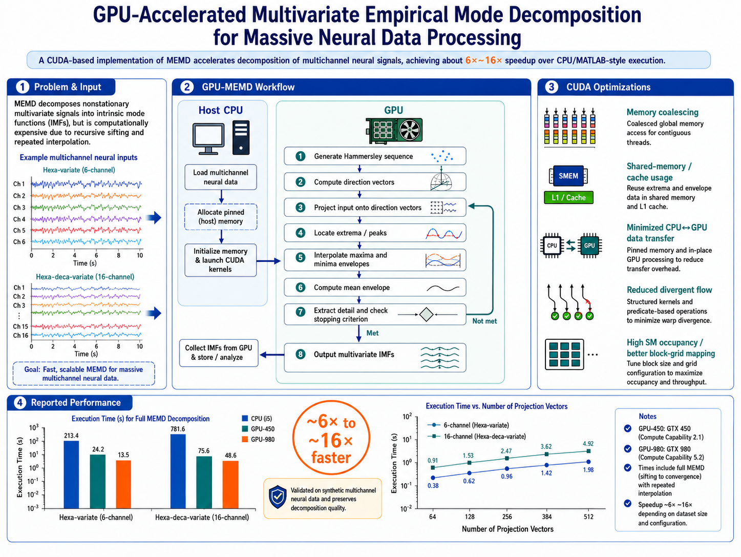
IoT, Fog, Vehicular & Smart-City Systems
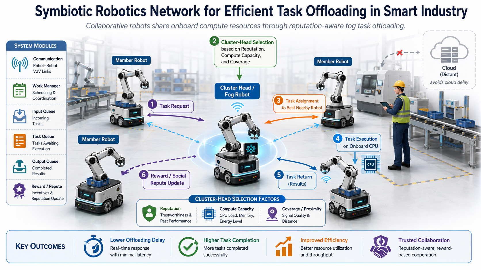
Symbiotic robotics task offloading
Symbiotic robotics networks for efficient task offloading in smart industrial environments.
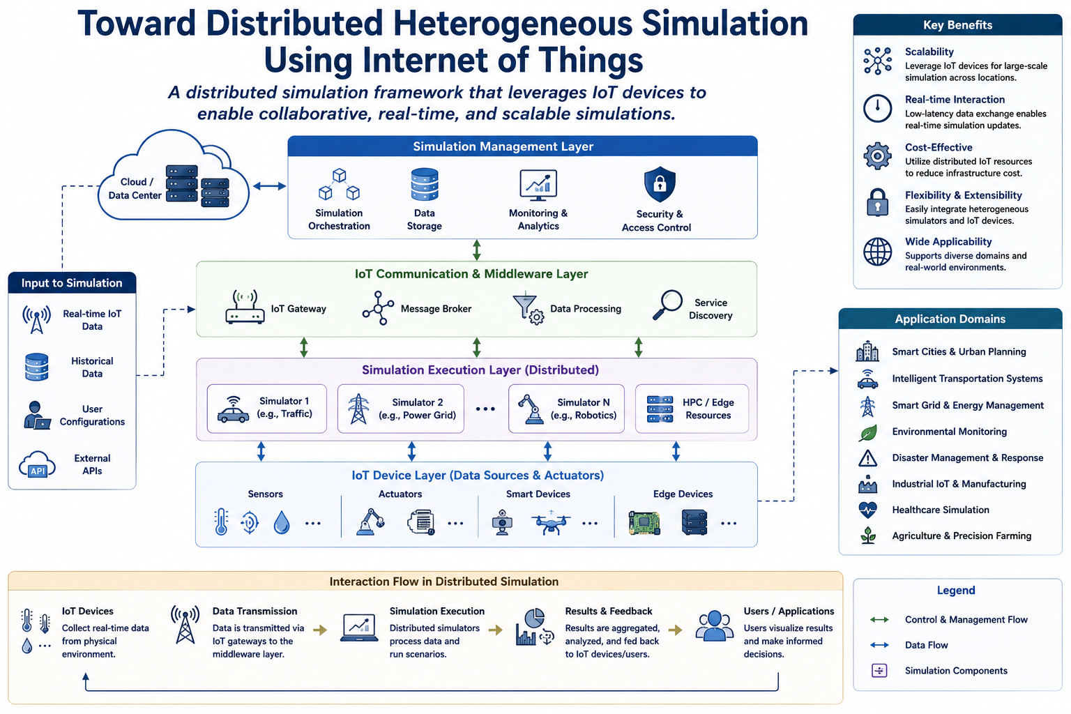
Distributed heterogeneous simulation using IoT
Simulation frameworks for connecting heterogeneous distributed systems and IoT environments for scalable modelling and evaluation.
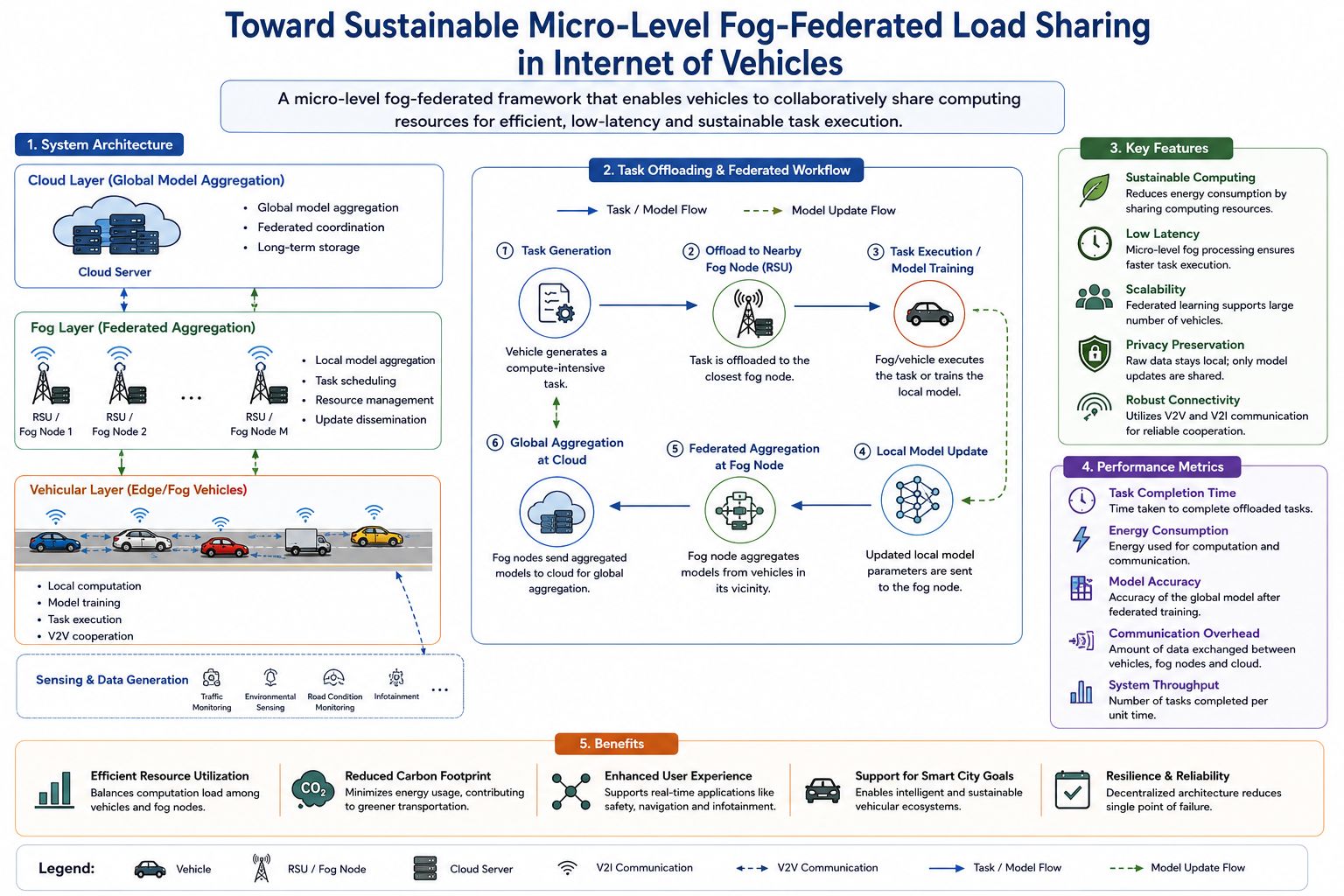
Fog-federated load sharing in internet of vehicles
Sustainable micro-level fog-federated load sharing for internet-of-vehicles environments.
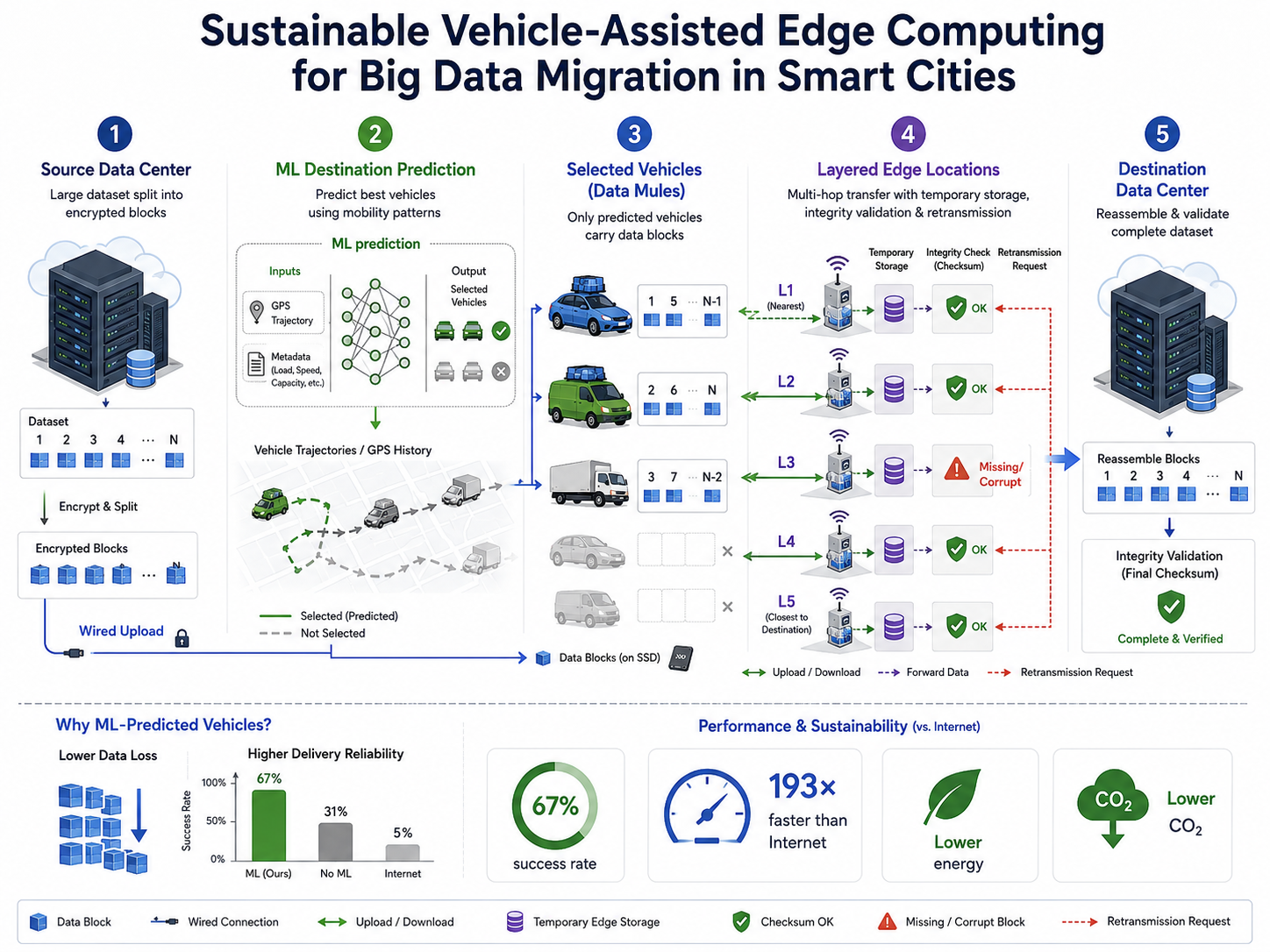
Sustainable vehicle-assisted data migration
Vehicle-assisted edge computing for efficient big-data migration in smart-city systems.
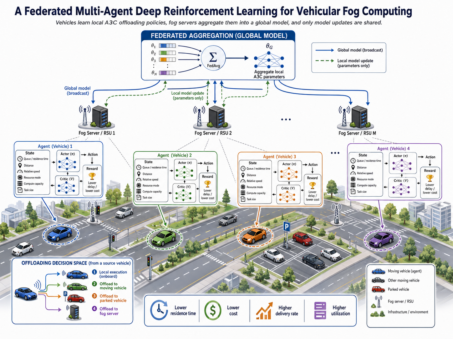
Federated deep reinforcement learning for vehicular fog
Federated multi-agent deep reinforcement learning for task offloading in vehicular fog computing.
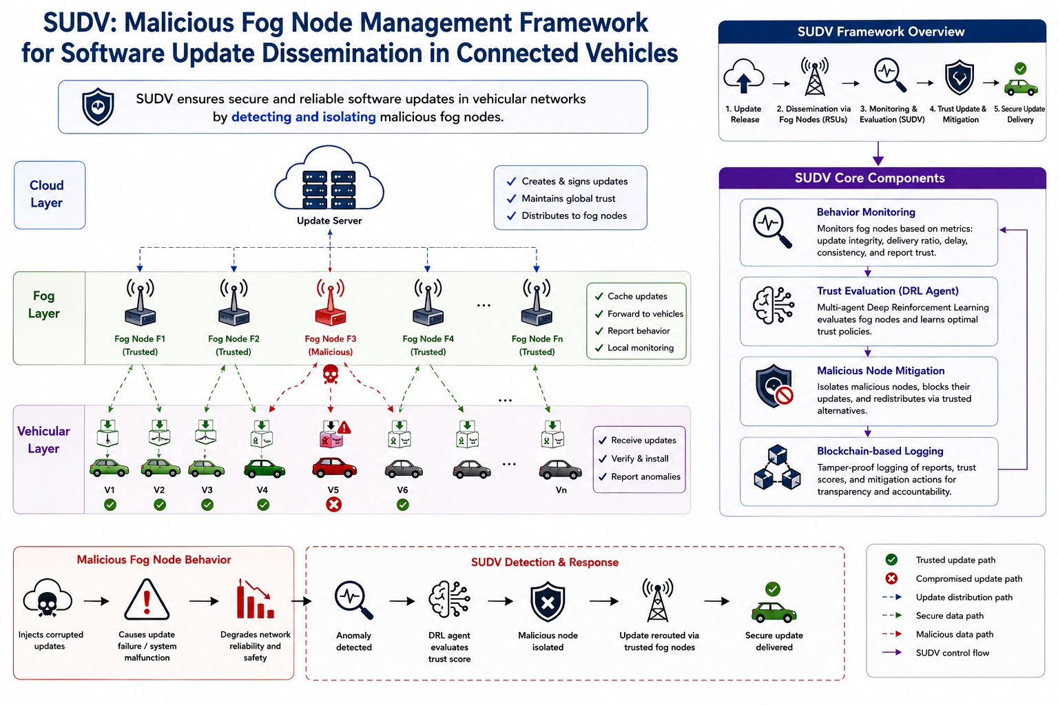
SUDV malicious fog-node management
Malicious fog-node management for software update dissemination in connected vehicle environments.
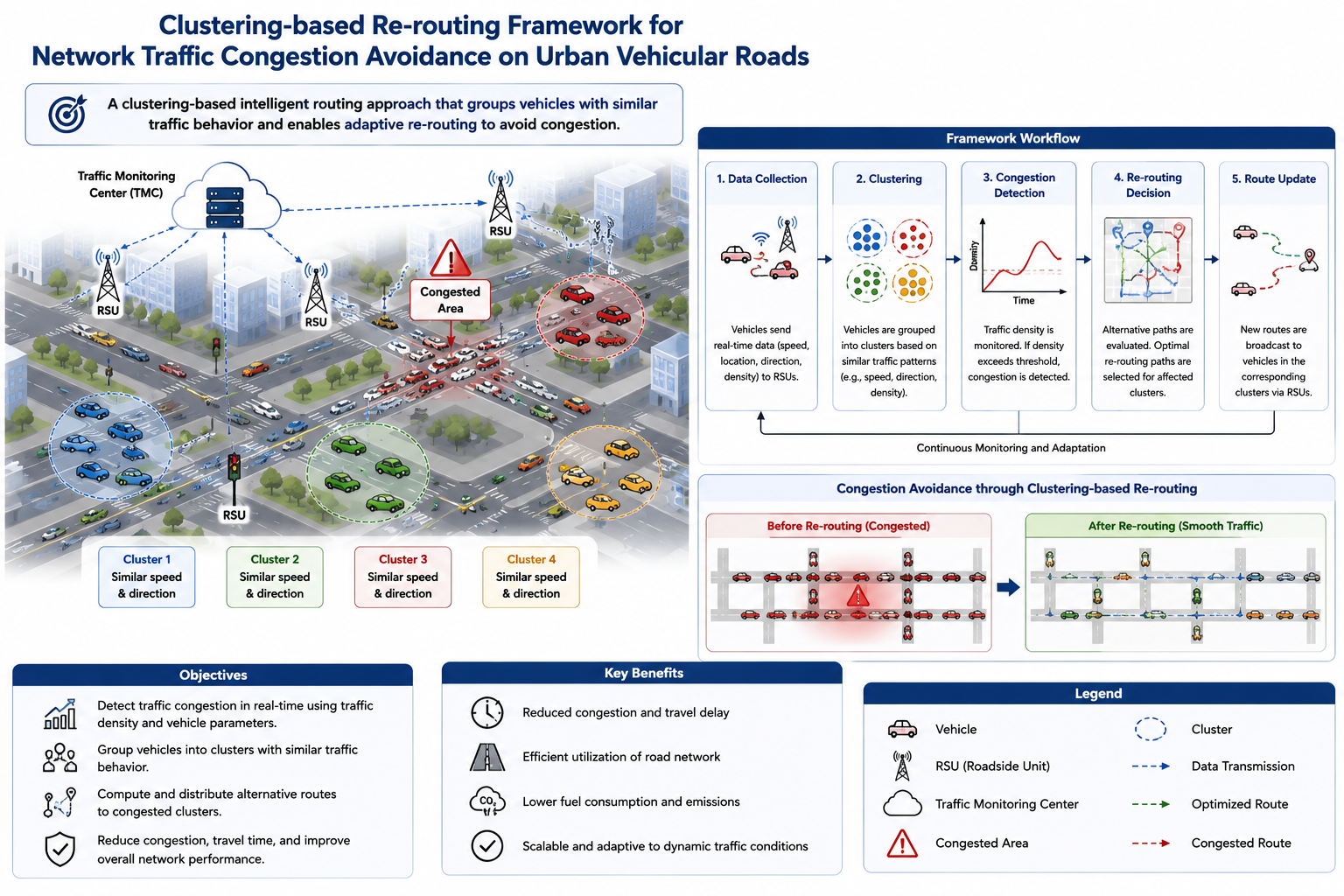
Clustering-based traffic re-routing
Network traffic congestion avoidance on urban vehicular roads using clustering-based re-routing strategies.
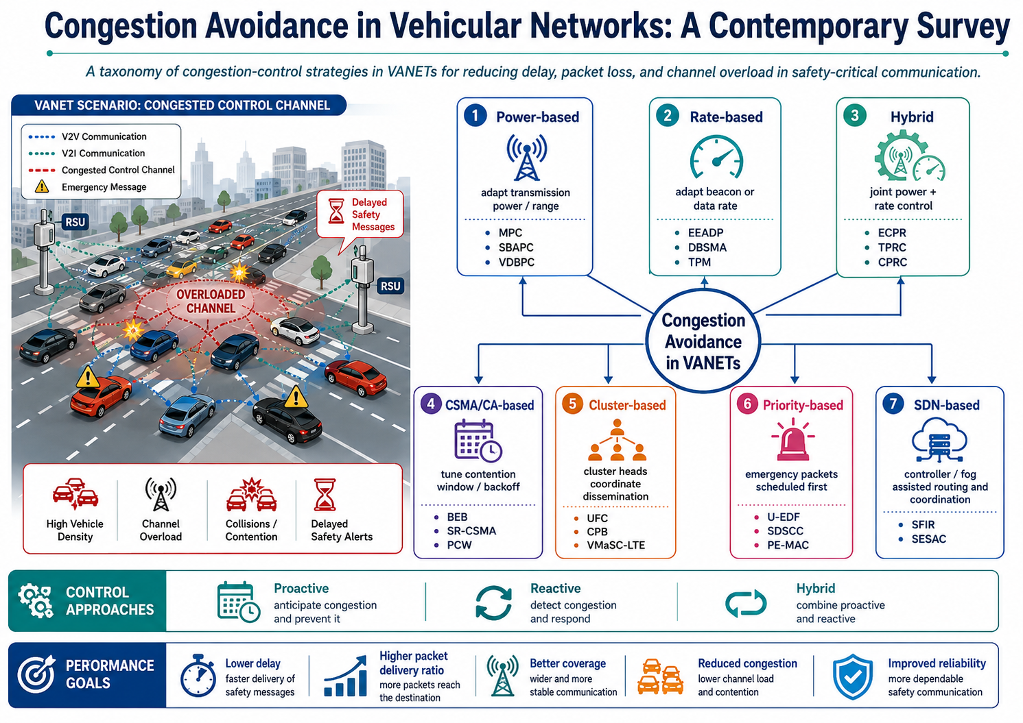
Congestion avoidance in vehicular networks
A contemporary survey of congestion avoidance methods in vehicular networks.
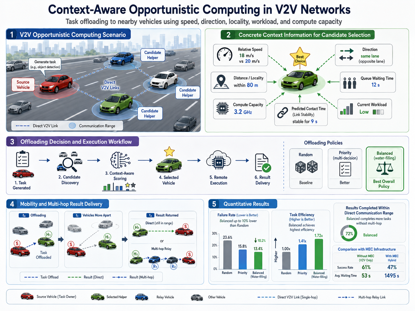
Context-aware opportunistic V2V computing
Context-aware opportunistic computing methods for vehicle-to-vehicle networks.
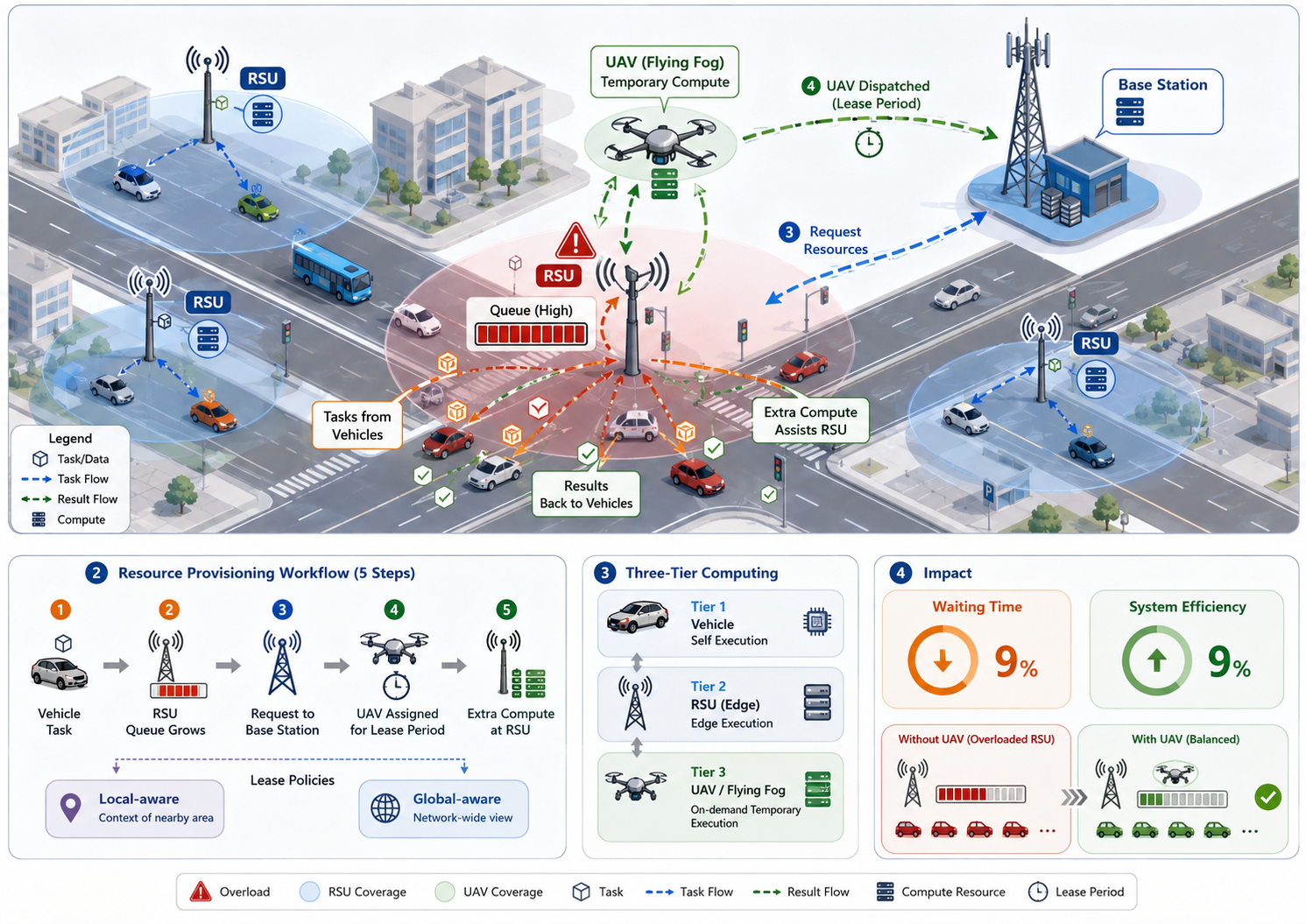
On-demand resource provisioning with flying fog
On-demand resource provisioning for vehicular networks using flying fog infrastructure.
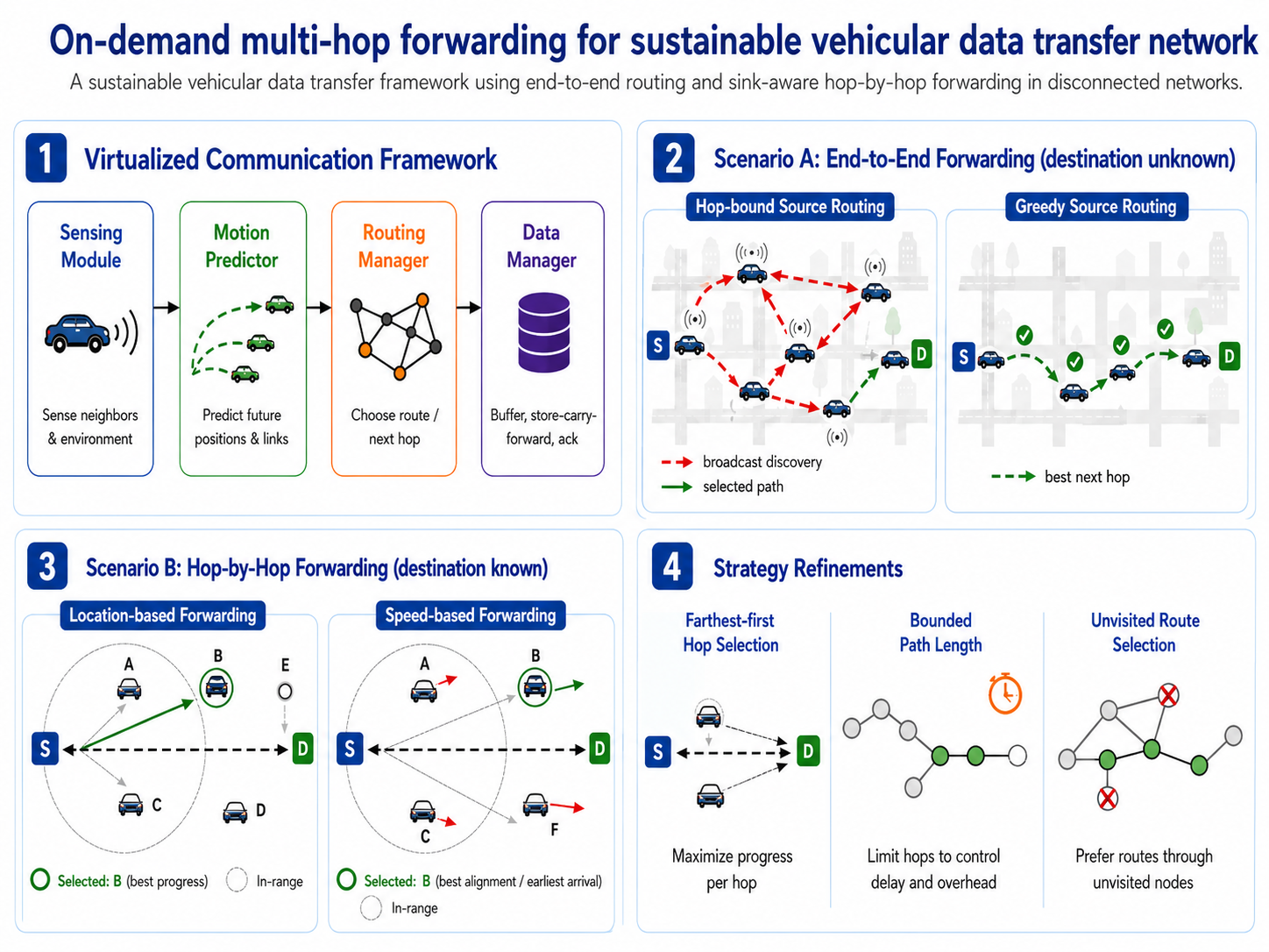
Sustainable multi-hop vehicular data transfer
On-demand multi-hop forwarding for sustainable vehicular data-transfer networks.
Federated fog for over-the-air vehicle updates
Over-the-air software-defined vehicle updates using federated fog environments.
Time-bound opportunistic forwarding
Time-bound single-path opportunistic forwarding for disconnected industrial environments.
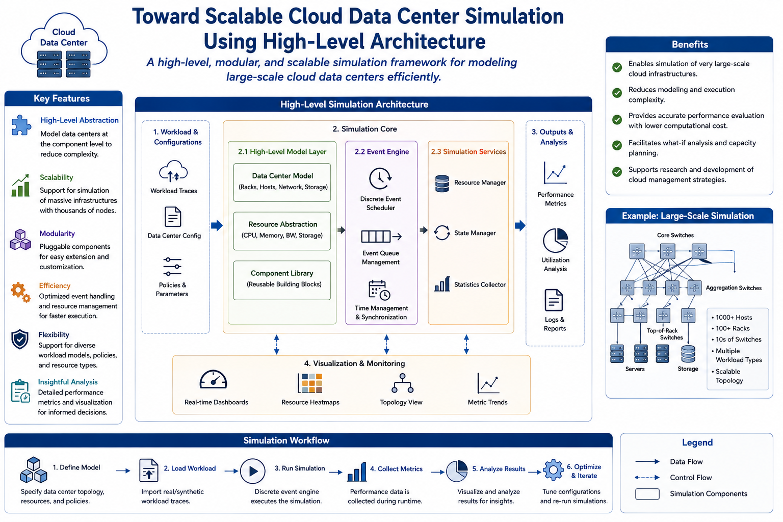
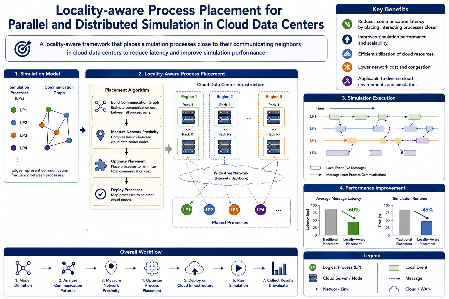
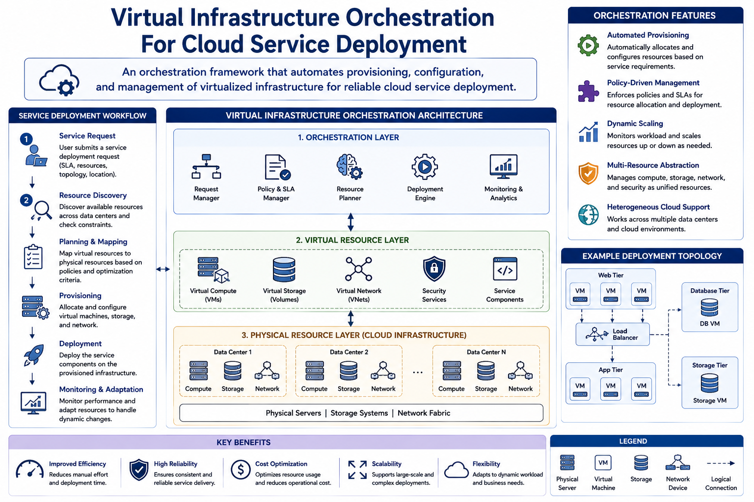
Scalable cloud and virtual infrastructure simulation
Cloud data-center simulation, process placement, and virtual infrastructure orchestration for cloud service deployment.
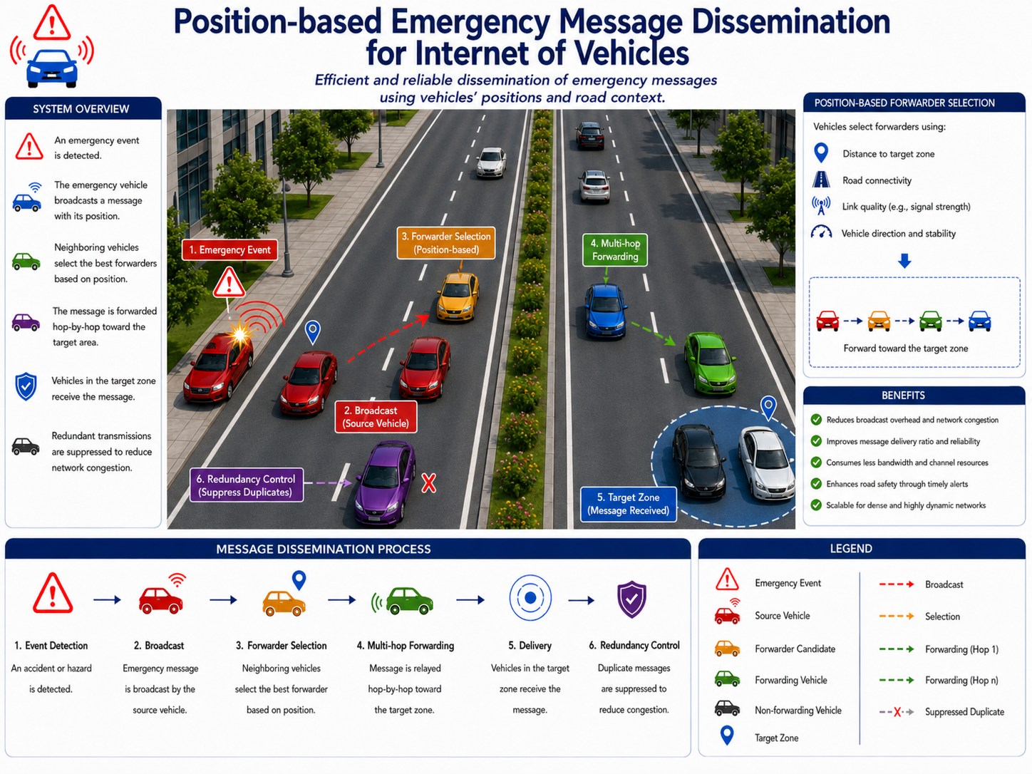
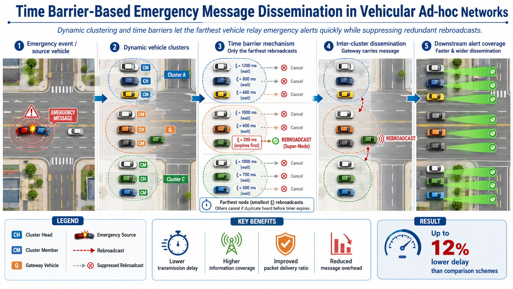
Emergency message dissemination in vehicular networks
Position-based and time-barrier-based emergency message dissemination for internet-of-vehicles and vehicular ad-hoc networks.
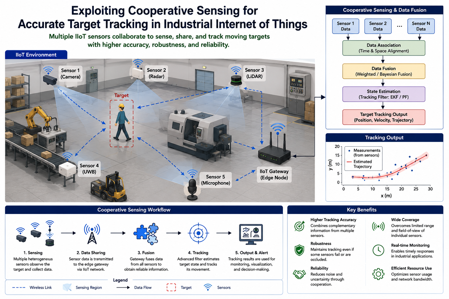
Vehicular sensing and intelligent transport systems
Vehicular-network-based transport management and cooperative sensing methods for smart cities and industrial IoT target tracking.
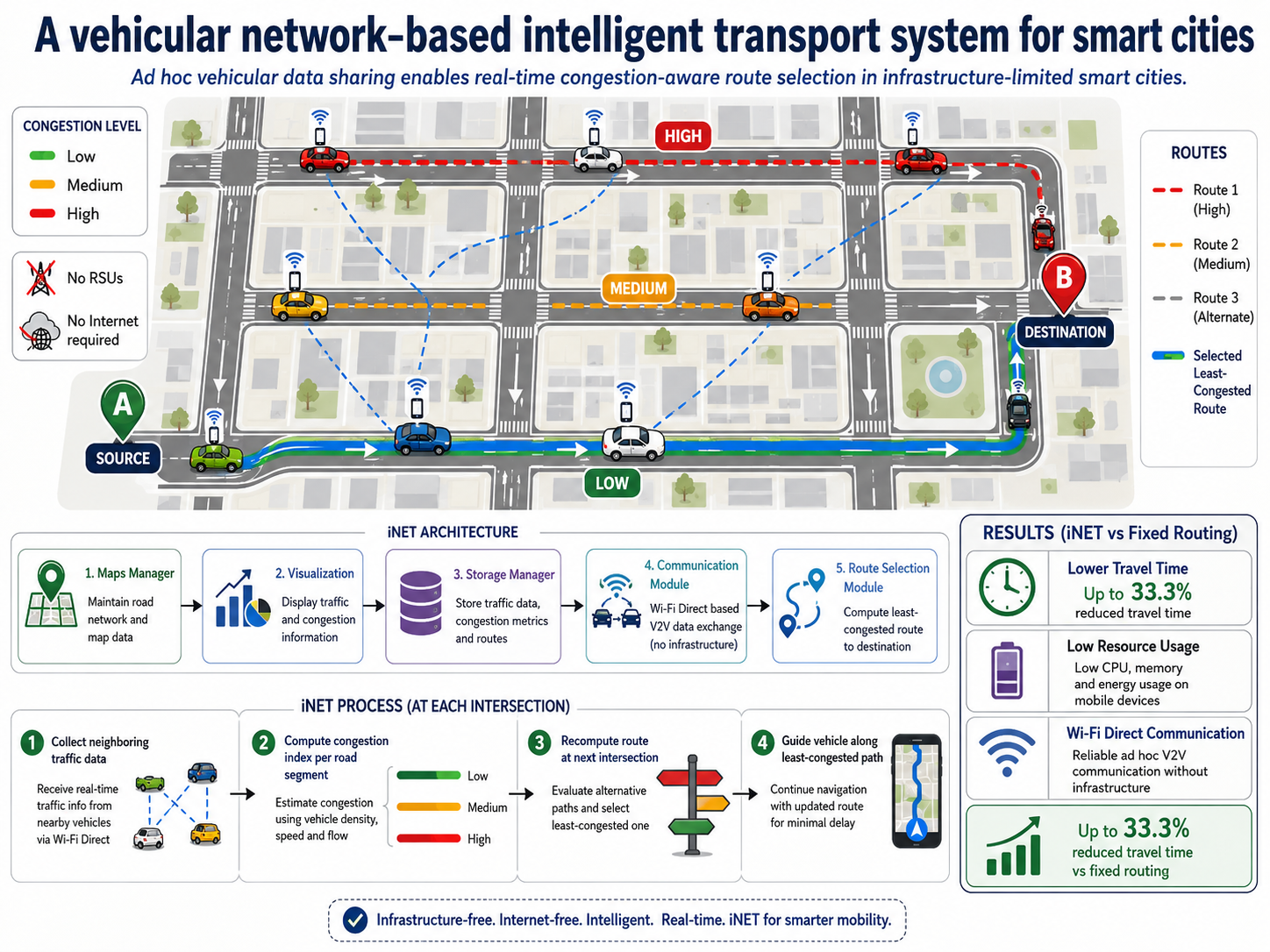
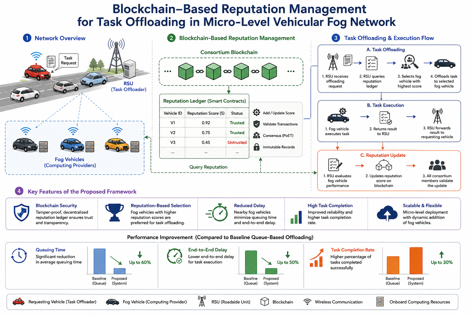
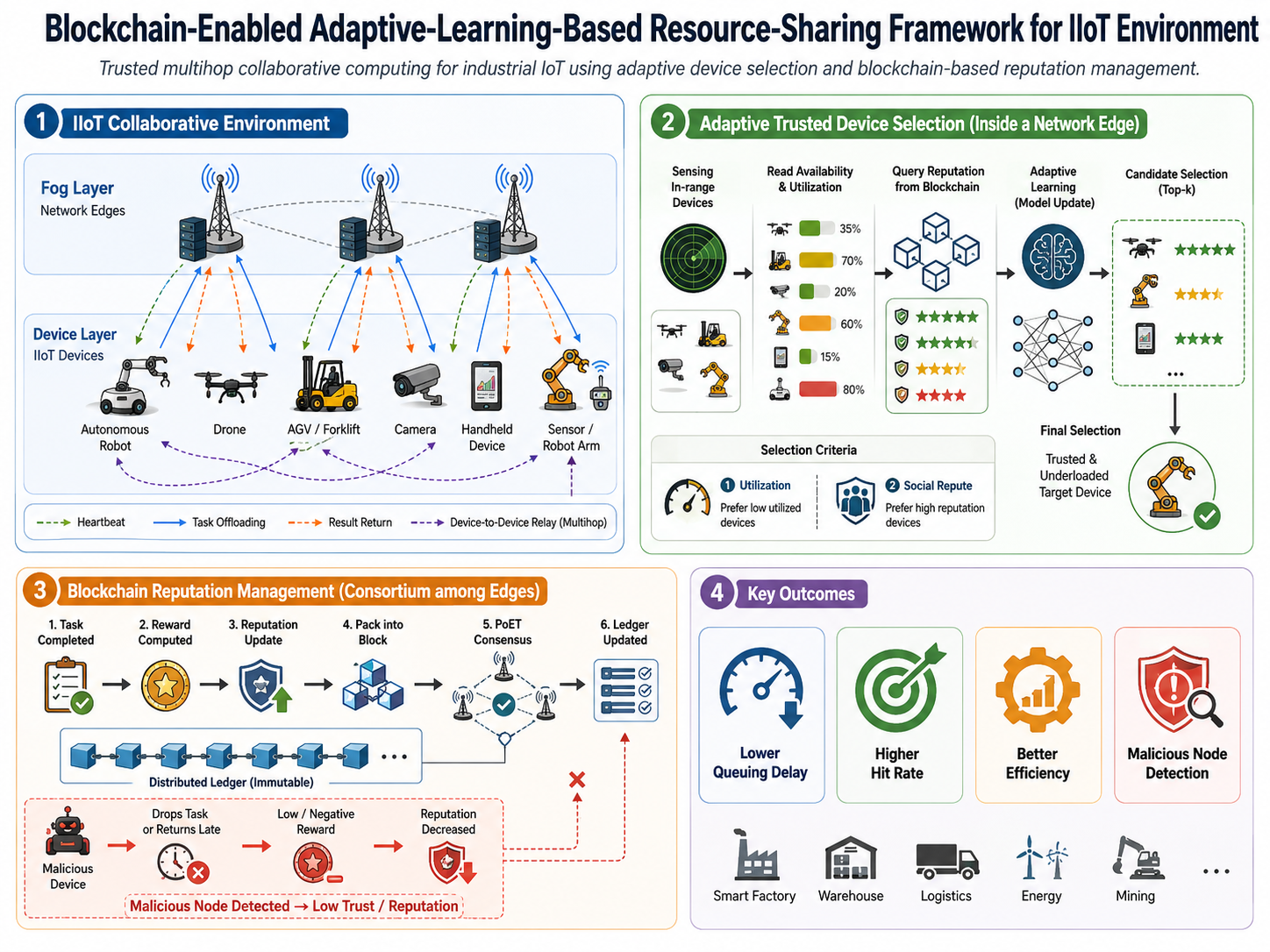
Blockchain and adaptive learning for vehicular fog
Blockchain-based reputation management and adaptive-learning-based resource sharing for vehicular fog, IIoT, and resource-constrained environments.
Health, Security & Data Systems
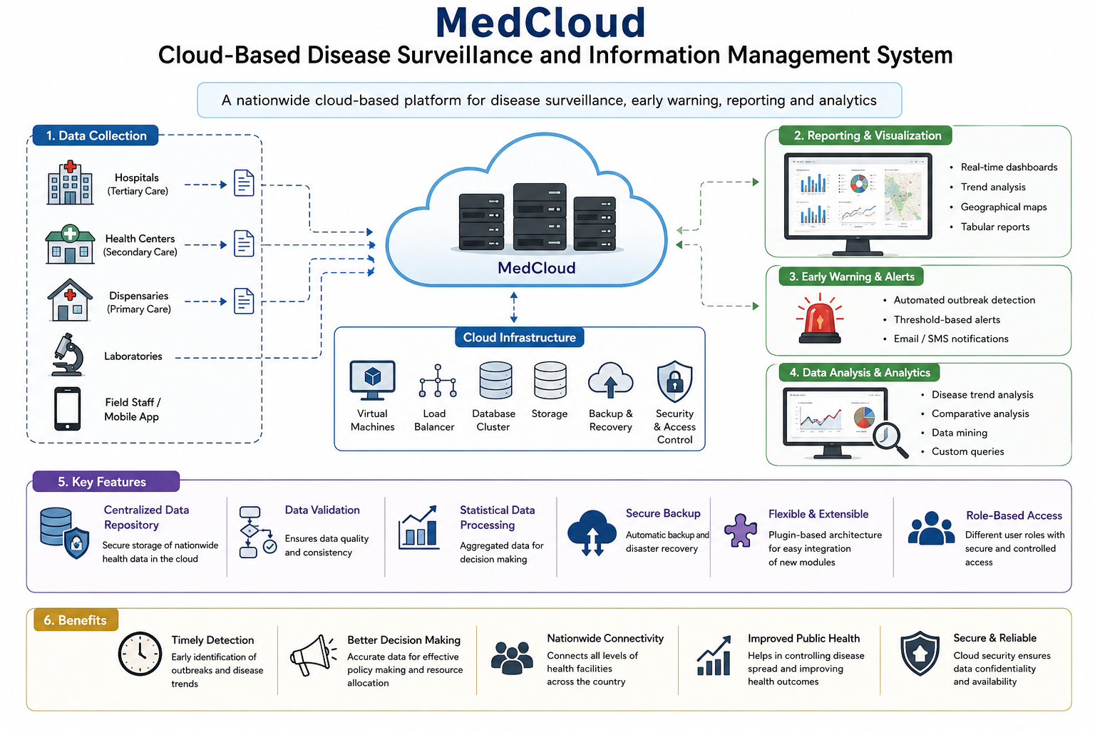
MedCloud disease surveillance
Cloud-based disease surveillance and information management for health monitoring workflows.
Indexing for wireless sensor network dissemination
Efficient indexing frameworks for data dissemination in wireless sensor networks.
Computer Vision & Visual Attention
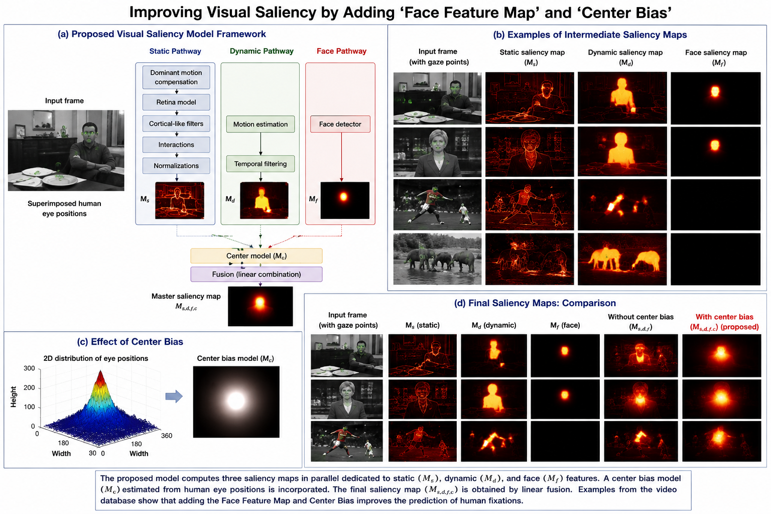
Face features and center bias in saliency
Visual saliency modelling that improves predictions by adding face-feature maps and center-bias mechanisms.
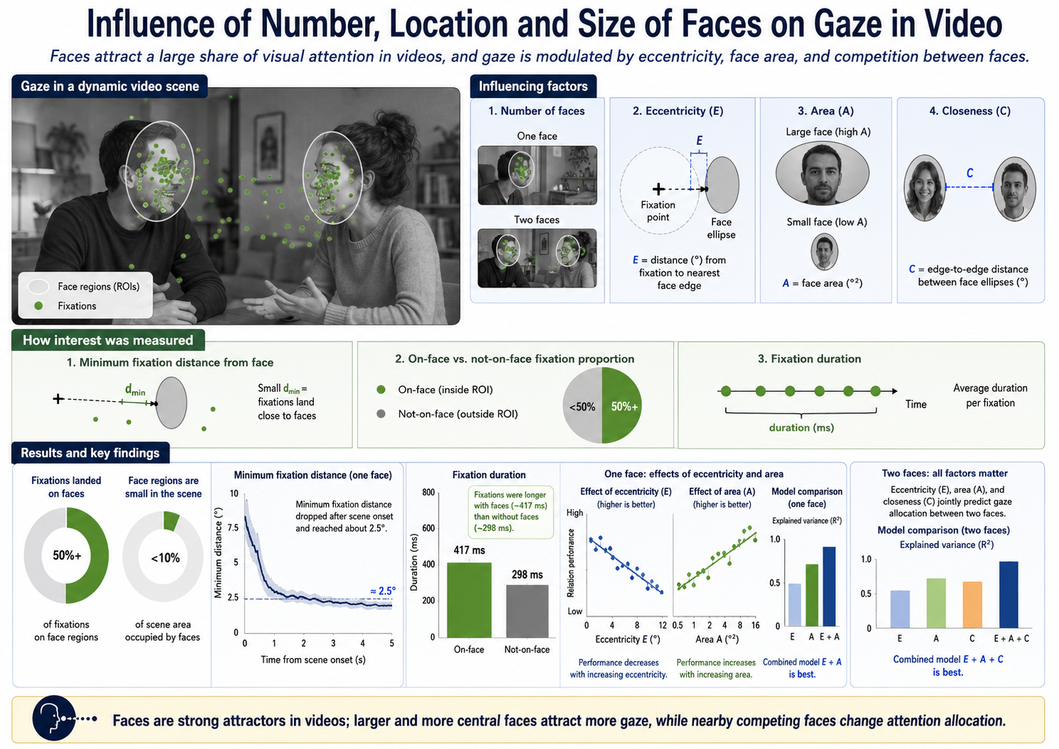
Face perception in videos
Studies of how face location, number, and size influence gaze behaviour in video.
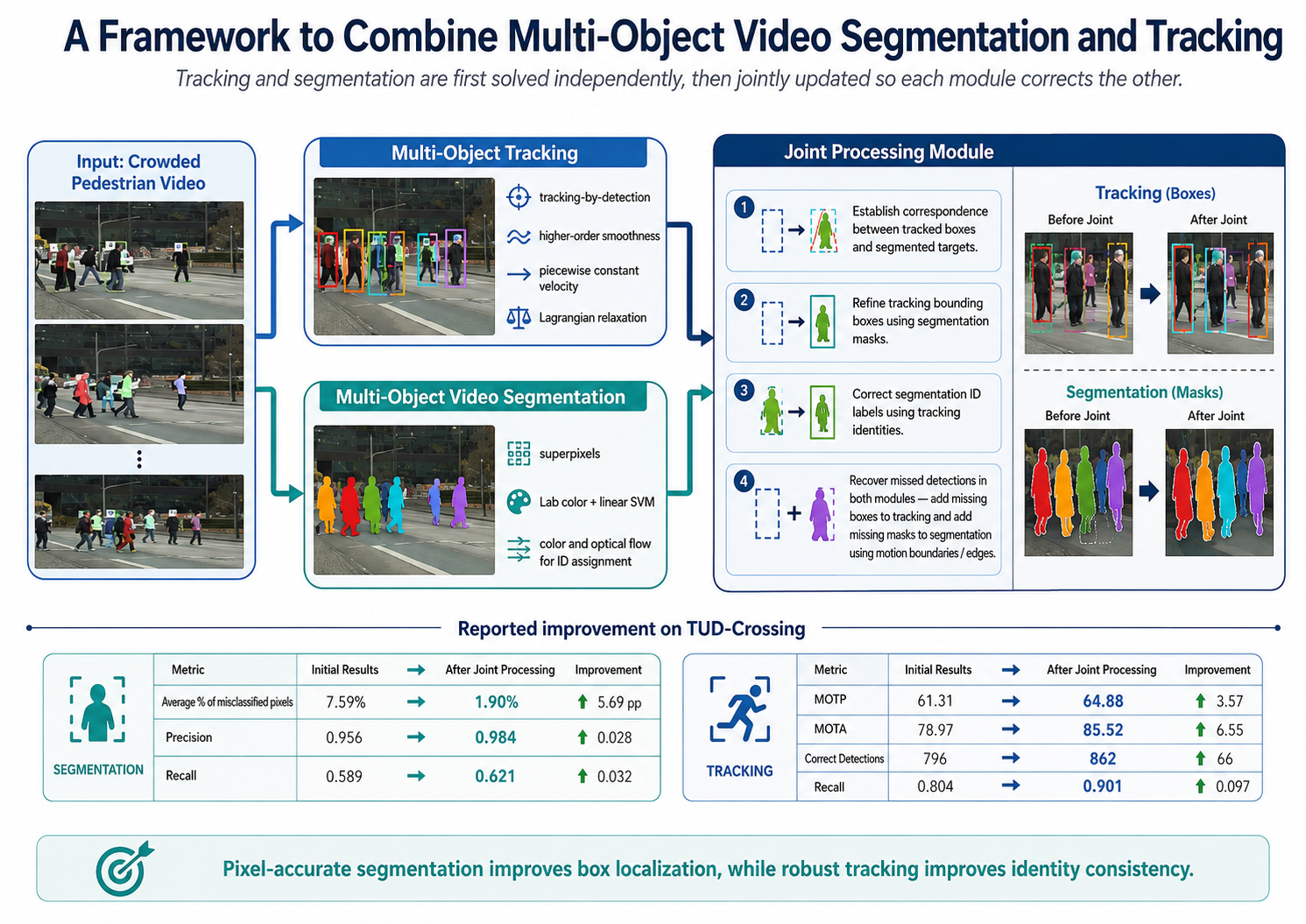
Multi-object video segmentation and tracking
Computer-vision methods combining multi-object video segmentation and tracking for object-level video understanding.
Unsupervised video object segmentation
Unsupervised video object segmentation using conditional random fields.
Datasets & Human-Centered Systems
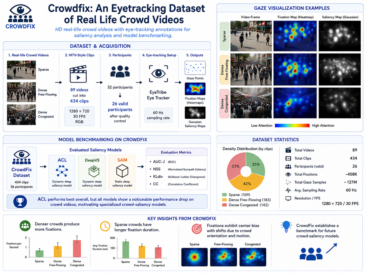
CrowdFix eye-tracking dataset
An eye-tracking dataset of real-life crowd videos for studying attention in sparse, dense free-flowing, and dense congested scenes.
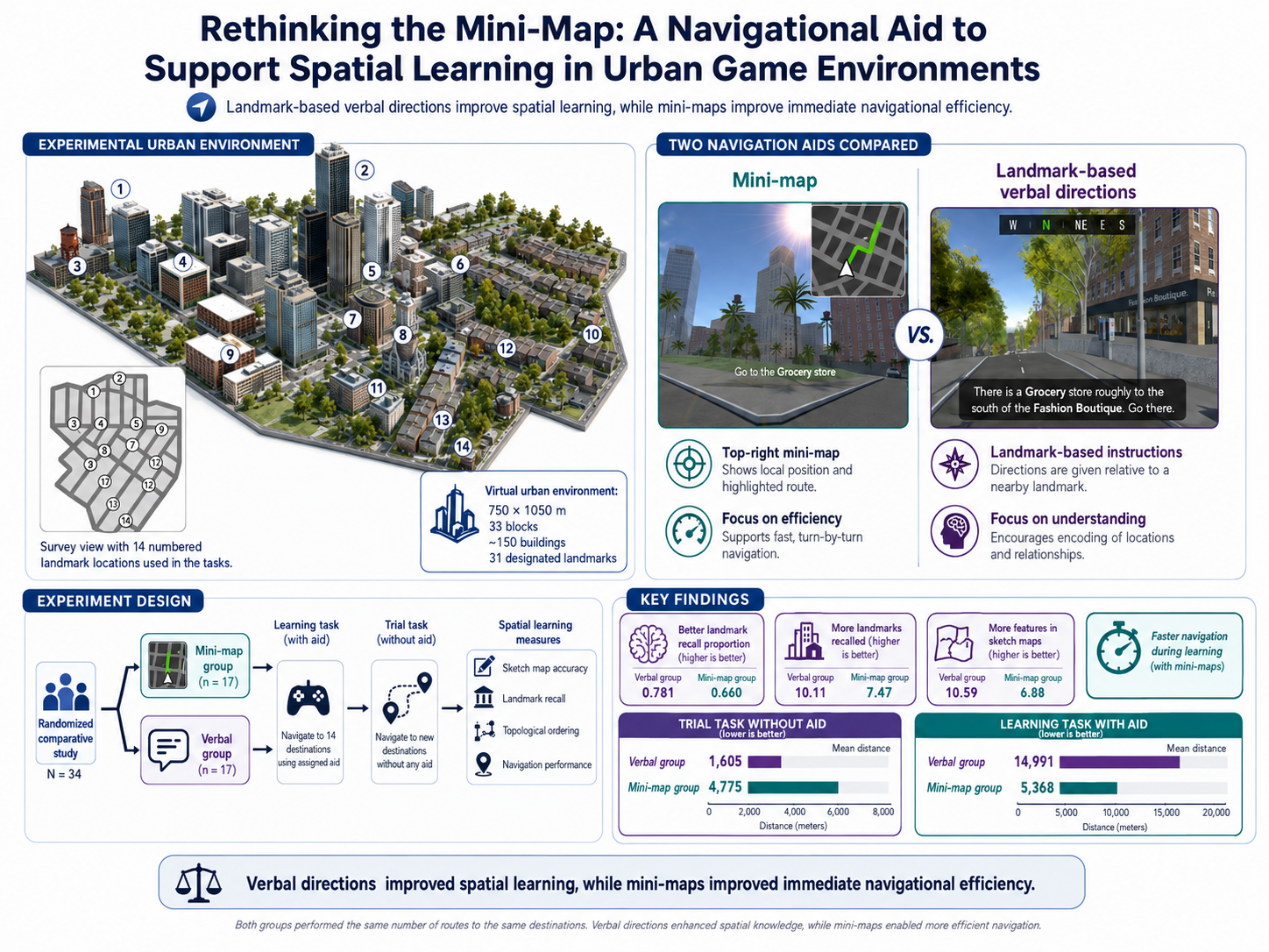
Rethinking mini-maps in urban game environments
A study of mini-map navigation aids and their impact on spatial learning in urban game environments.
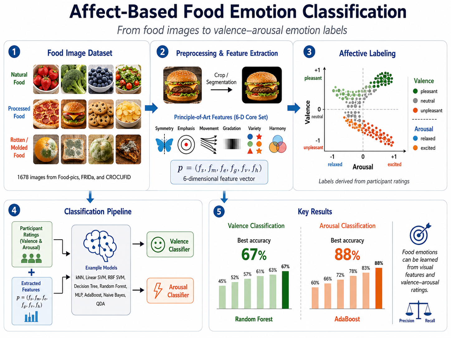
Affect-based image classification
Image classification work connecting visual features with affective emotion categories in food imagery.